Likely to be one of the first events to take place in Australia in the lead up to the commemoration of the 250th anniversary of Lieutenant James Cook’s charting of the eastern coasts of Australia in 2020, Mallacoota played host to an exciting project last weekend Restoring Cook’s Legacy 2020.
While Cook was a stickler for accuracy, many land features or landmarks that he named are shown in the wrong place on today’s maps. The 250th anniversary of his voyage provides an opportunity to correct these errors.
Cook’s practical purpose in naming land features was to assist later navigators on the coast to determine their position. Accordingly, the land features he named are prominent and usually easily recognised from well out to sea, being distinctive mountains or cliffs, notable islands or trends of the coast.
Restoring Cook’s Legacy 2020 is a project of Australia on the Map (AOTM), the history and heritage division of the Australasian Hydrographic Society, and is managed by Australia on the Map Division.
The first phase of the project aimed to identify, from Cook’s primary data, the intended locations of his 28 named landmarks on the coasts of Victoria and New South Wales; to identify the current official positions of these landmarks, and any published material questioning their proper position; and determine how errors and misunderstandings originated and who was responsible, and publishing the results.
Project manager, Trevor Lipscombe, said nine errors or misunderstandings were identified during this phase of the project.
“For the first time in nearly 250 years we now have an accurate public record of what Cook actually saw and named on the coasts of present day Victoria and New South Wales,” he said.
The project will continue to enlist the support and endorsement of key organisations as supporting partners to demonstrate wide support for the project objectives, and influence governments to act on renaming and heritage listing; create a virtual James Cook Heritage Trail along the coasts of Victoria and New South Wales on a new website; raise awareness of the heritage values of the Cook Landmarks, many of which remain as they were in Cook’s time, to secure their heritage listing and protection; broaden understanding of Cook’s legacy on these coasts through related talks, articles and events in the lead up to and during 2020; and work to achieve the renaming of at least one of the misplaced Cook Landmarks in each of the three jurisdictions, Victoria (Ram Head), New South Wales, and Jervis Bay Territory (Cape St George).
Last weekend interested parties gathered in Mallacoota to commemorate the 250th anniversary of Lt James Cook’s departure from Plymouth, United Kingdon, on August 25, 1768.
The weekend attracted a lot of interest with about 60 participants who enjoyed an illustrated talk by Trevor, ‘Lt James Cook on the coast of Victoria – a comedy of errors’. Trevor is one of very few people to have stood on the ‘hillock’ at both Ram Head, UK and Ram Head, Victoria.
Self guided walks as well as drives to Cook features in the area were also enjoyed, including remote Little Rame Head the real Cook’s Ram Head the first land feature named by Cook on the Australian coast.
Some also embarked on flights over the area on Sunday, including Snowy River Mail photographer, Rene Sundermann, to get a bird’s eye view of the landmarks they’d discussed earlier.
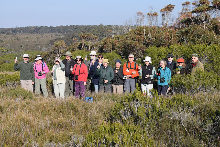
PICTURED: Participants from Canberra, Bairnsdale, Bega and Ulladulla joined locals and Australia on the Map executive officer, Peter Reynders, on a trek along Mallacoota’s rugged coast to visit landmarks that the Restoring Cook’s Legacy 2020 project seeks to correct mapping errors for and toasted to their success having reached the summit of Cook’s Ram Head. S329-12/25
Project to restore Cook’s legacy